Brandt Impoundment - Project 60D
Project Location
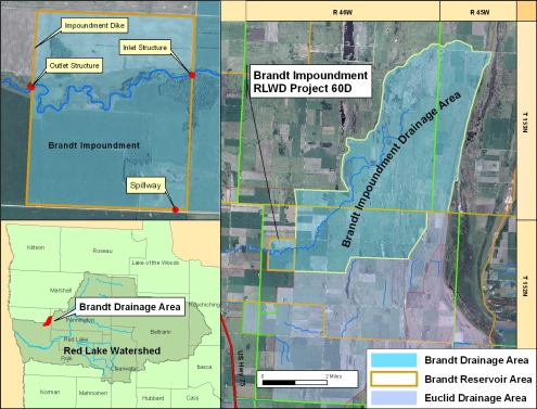
The Brandt impoundment project (RLWD Project 60D) is located in Section 7 of Belgium Township in Polk County. It is approximately 14 miles north of Crookston, about a half mile east of U.S. Highway 75.
Design Considerations
The Brandt Project is designed to reduce downstream agricultural and urban flood damages by retaining up to 3,912 acre-feet of excess runoff from the upstream drainage area. This impoundment facility will reduce peak discharges on the downstream "Brandt Channel", RLWD Ditch 15 and Polk County Ditch #2.
Project Components
The design consists of approximately 3.5 miles of earthen embankment (492,579 cubic yards and up to 19 feet in height), a grass lined emergency spillway, two lines of 6' x 8' concrete box culverts, and a gated concrete outlet structure.
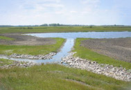
Operable components are the gated structure which releases water from the impoundment into the Brandt outlet channel. This water then flows west-northwest through RLWD Ditch 15, into Polk County Ditch #2 system and eventually flows into the Grand Marais River.
The project became operational in the spring of 2008. The Red Lake Watershed District and HDR Engineering of Thief River Falls jointly performed construction surveying and inspection duties. The project is funded by the State of Minnesota, Red River Watershed Management Board, and the Red Lake Watershed District.
Functional Design Data
Feature |
Measurement |
Storage (acre-ft.) |
|---|---|---|
| Top of Dam (Total Storage) | 918.0 Ft. msl | 3,912 (3.1 in. runoff) |
| Secondary Spillway | 914.5 Ft. msl | -- |
| Ungated Storage to Emergency Spillway | 916.0 Ft. msl | 786 (0.62 in. runoff) |
| Gated Storage | -- | 3,126 (2.48 in. runoff) |
| Drainage Area | 23.6 Sq. Mile | -- |